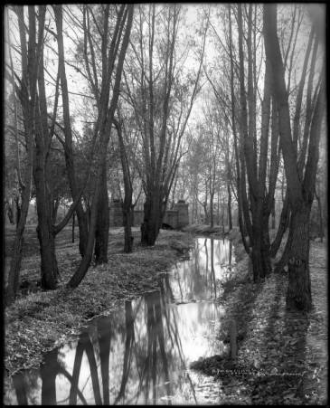
A Visual Timeline

- A Ditch in Autumn, Courtesy DPL, Western History Collection, MCC-870
If you have ever wondered about how the La Alma Lincoln Park neighborhood was built and developed as part of Denver over time, this post should offer a few insights. Some of the most informative records we have are embedded in the lines and markings on maps and drawings. With many structures lost to flood, neglect or progress, these visual records offer a wealth of clues to the past. They also help to represent the legacy of the lost architectural gems, and bring more to light about the historic character of the neighborhood.
However, because Denver experienced periods of great growth and speculation, publications are not usually 100% accurate. Buildings may have been built or destroyed before the cartographer’s research was distributed. Records are only as good as the people or circumstances that created them. Just as the deed to our home indicates a build date of 1890, the Denver Directory suggests the residence was occupied as early as 1885. It has been most productive to think of these documents as providers of clues or supporting evidence for hints already uncovered.
As you peruse the maps below, I will try to highlight significant elements, and help guide you through the streets and landmarks of old Lincoln Park. You can refer to a map of the neighborhood today by clicking HERE or the image below
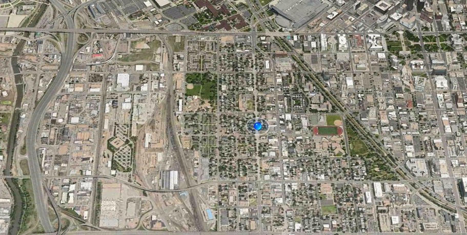
La Alma Lincoln Park by satellite
.The Map of Annexations
Most maps show the first Congressional Land Grant stopping at Colfax, excluding Lincoln Park from the original Denver City boundaries. The map and key below would support the notion that A C Hunt, known to be present and involved in the earliest machinations of government here, worked to improve his homesteading claim across the creek. The land was included in the first legal expansions to the city limit.
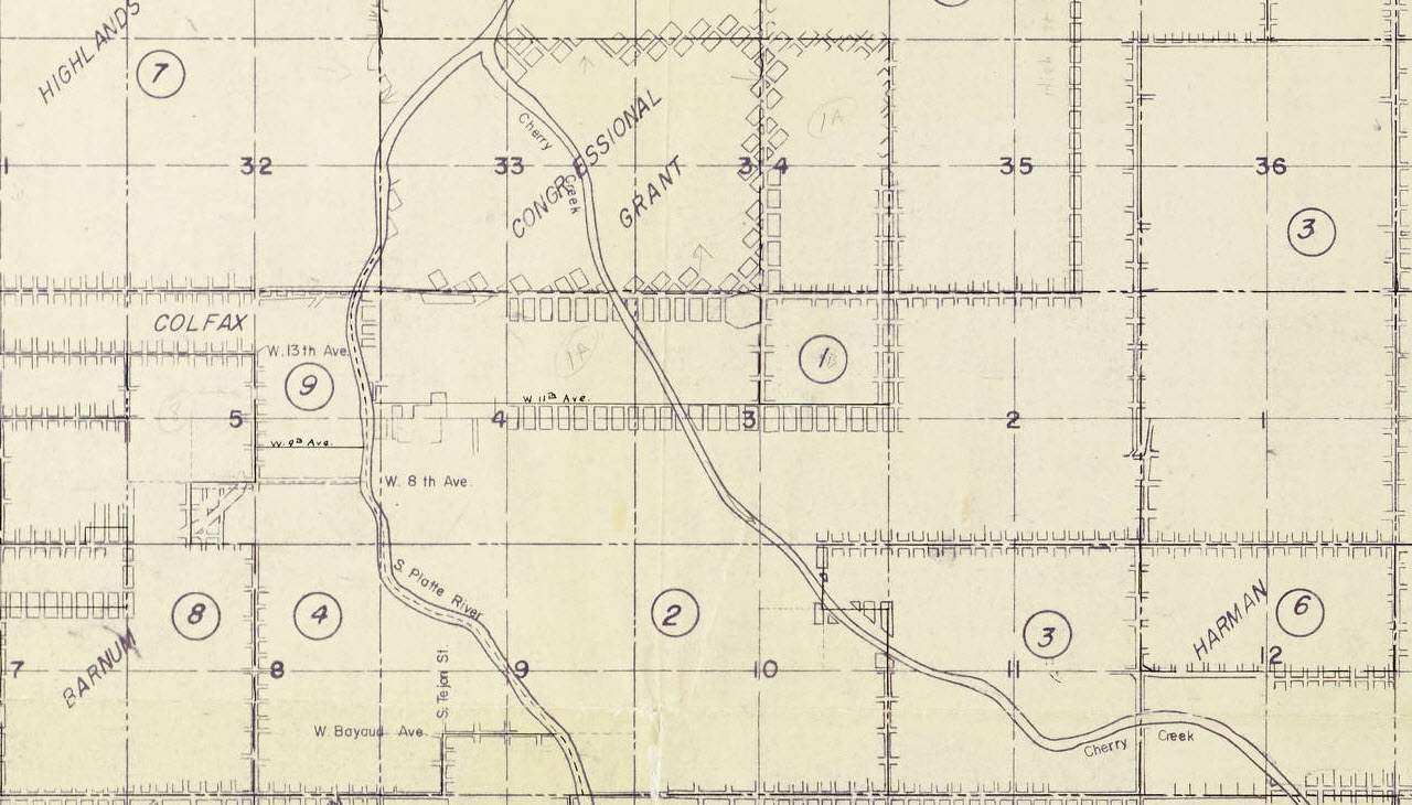
Map of the annexations to the city and county of Denver (Zoom) Courtesy DPL, Western History Collection CG4314.D4 1959 (oversize)
According to this document, part of Lincoln Park was first added to Denver down to about 11th Street in 1875 (Area1 on the map), and the rest of the neighborhood was included by action of the state legislature in 1883 (Area 2). Another annexation does not occur until 1889.

Map of the annexations to the city and county of Denver (Key Zoom) Courtesy DPL, Western History Collection CG4314.D4 1959 (oversize)
Pushing the City Limit- 1878 & ’79
Aside from the Hunt homestead and Camp Weld, Lincoln Park didn’t really made it to the map until the 70’s. After the Denver & Rio Grande laid it’s track through part of Governor Hunt’s property, the railroad offered the jobs that stimulated this neighborhood’s development. Although the floods would devalue this land across the creek, it would become a home to many of Denver’s working class citizens.
We can also see more clearly, the line of the first annexation mentioned above. The “City Limit” runs between Deer and Moose, about a half a block south of Eleventh St. today. Also visible here: Clover Park, A C Hunt’s house, the first County Jail, and County Poorhouse.
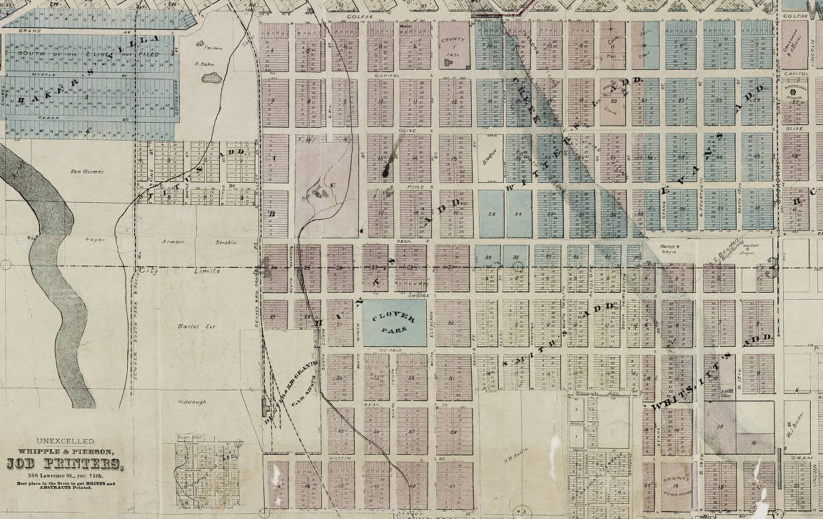
Map of Denver, the capital of Colorado : compiled from the official records. Willits, W. C. (Warren C.) 1878. Courtesy of DPL, Western History Collection CG4314.D4 1878.W5
In these early maps, we definitely see the progress of plans to build up the area, as well as the historic subdivisions that comprise today’s larger La Alma Lincoln Park neighborhood. Besides Hunt, readers may recognize Witter, Smith and Whittsitt from the eastern half and Baker, Titus, and Milleson west of the tracks. Homeowner’s may have noticed that their property record likely corresponds to one these pioneer developers, homesteaders, and city builders. Interestingly, Colfax Avenue did not always run so far to the west as it does today, with Grand Avenue starting west of the RR tracks and the Excelsior Mill Ditch at Curtis Street.
Thayer’s map of Denver, Colorado 1879. Courtesy DPL, Western History Collection CG4314.D4 1879.T49
The First Birds’ Eye Perspectives- 1881,1882
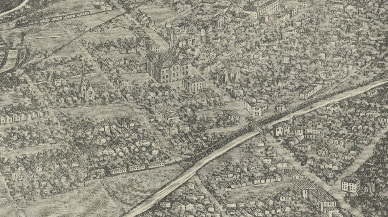
Much thanks to these artists, whose birds’eye perspectives offer the best depictions of our fair city in the early years. While the southwestern part of town is often on the edges of or excluded from these images, cropping and zooming can capture more detail than apparent at first glance. This one from 1881 offers a snapshot of the settlement’s outskirts, about twenty years after Denver’s start.
Bird’s Eye View of the City of Denver, Colorado, 1881. Flett, J. H. Courtesy Library of Congress G4314.D4A3 1881 .F6
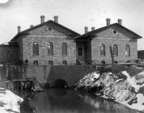
Again, Hunt’s “Cloverside” in today’s La Alma Lincoln Park, and the County Jail at 14th and Santa Fe are seen. There are long-gone homes on the northern edge of Hunt’s homestead, along today’s 13th St. in today’s park. The Central School is visible on South Eleventh (Kalamath St.) and the newly built church that still stands today on 11th St. (Deer) appears. The “Three Stone” buildings standing today on Denver Water’s campus are here and the D&RG shops are drawn with some good detail.
Bird’s eye view of the city of Denver Colorado 1882. Courtesy DPL, Western History Collection, CG4314.D4 1882 F55
A different crop adds more context to the development of the neighborhood and city. It is uncommon to see how Grand Ave actually tied to Auraria at Curtis and Larimer, and joined with Morrison Road after crossing the South Platte River. Villa Park would later obliterate that connection.
Whatever inaccuracies these renderings may display, they certainly paint a vivid image of an early stage in the neighborhood’s development. Did you notice the Denver Circle Railroad’s tracks running along the Cherry Creek bed before heading down today’s Inca Street?

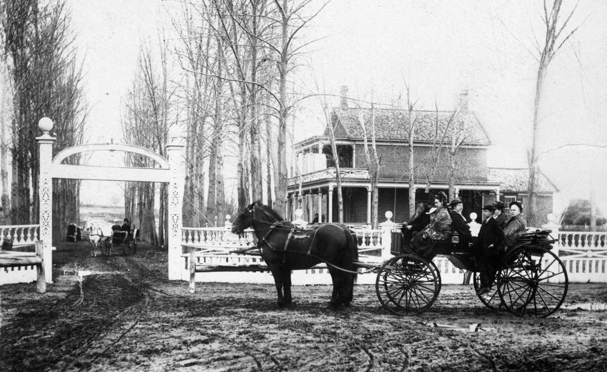
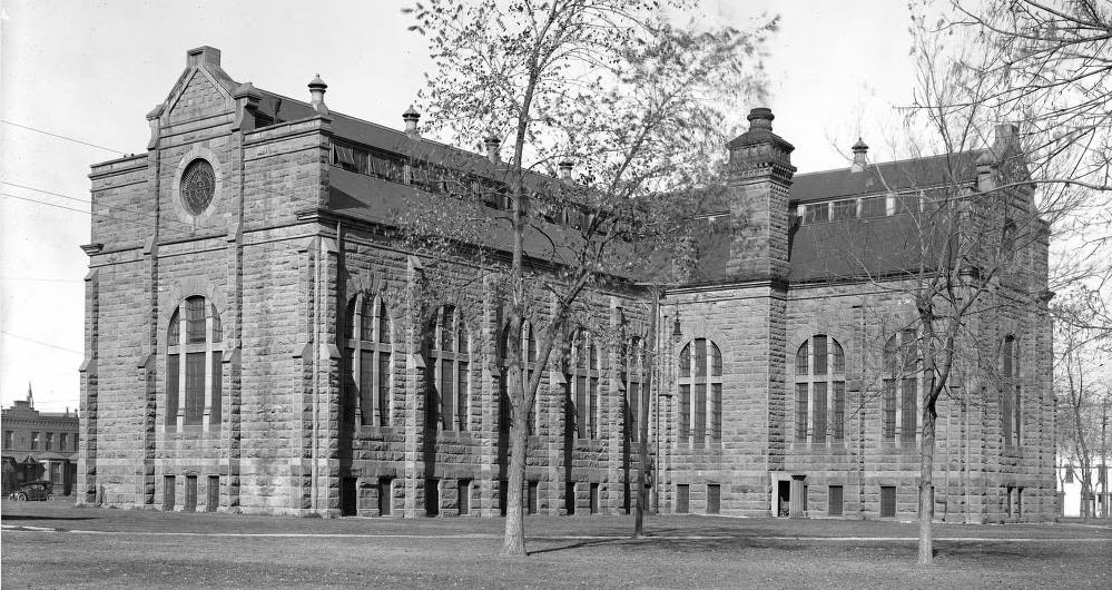
- Governor Hunt’s “Cloverside” Homstead. From Cannon, Helen, First ladies of Colorado–Ellen Kellogg Hunt.: SER Colorado Magazine Vol. 39, no. 2 (pp. 125-132)
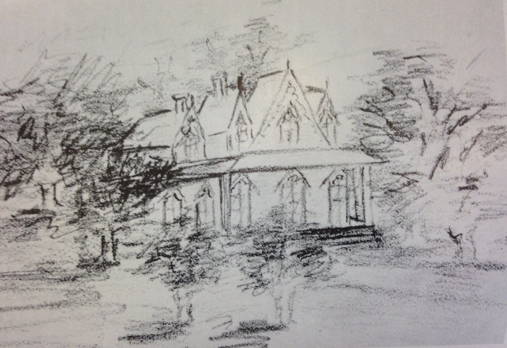

- The Three Stone Buildings and Water Works. Courtesy DPL, Western History Collection, X-18935

- Central School prior to 1952 demolition. Courtesy DPL, Western History Collection WH 1990

- 1st. Seventh Day Adventist Church W. 11th Ave at Kalamath. Courtesy DPL, Western History Collection X-25701

“Latest Map of the City of Denver” 1882
This map was used for the promotion and development of Villa Park. It elaborates on the growing network of streets, railways, and canals, and illuminates how quickly Denver was growing. Most significant to neighborhood history are the track route of the Denver Circle RR, Lake Archer, and the Denver & Rio Grande. We can still see Hunt’s house in what would become “Lincoln Park” in 1885.
Latest Map of the City of Denver 1882. Courtesy DPL, Western History Collection, CG4314.D4 1882.L3c
Baker’s Villa – 1886
On several maps, we see the landholdings of Nathan Addison Baker stretch from the Platte to the D&RG tracks, just south of Colfax/Grand Ave. Readers may remember Nathan from Baker Spring’s role in our water legacy story. Upon his death, Baker’s heirs planned to follow through with the development and the survey map above describes the subdivision in detail.

Map of Bakers Subdivision of lands in the City of Denver. ColoradoCourtesy DPL, Western History Collection CG4314.D4 1886.B3
Other maps show a residential character did once exist there, but perhaps most interesting, is how altered the landscape actually became. Numerous floods washed all the houses away eventually and the area between the railroads and river/highway eventually became much more industrial, and separated from the rest of the neighborhood. The area is today receiving renewed attention with MSU’s new athletic complex rising and long neglected lots attracting interest from residential developers.

- Addison Baker Home. Courtesy DPL, Western History Collection X-19782
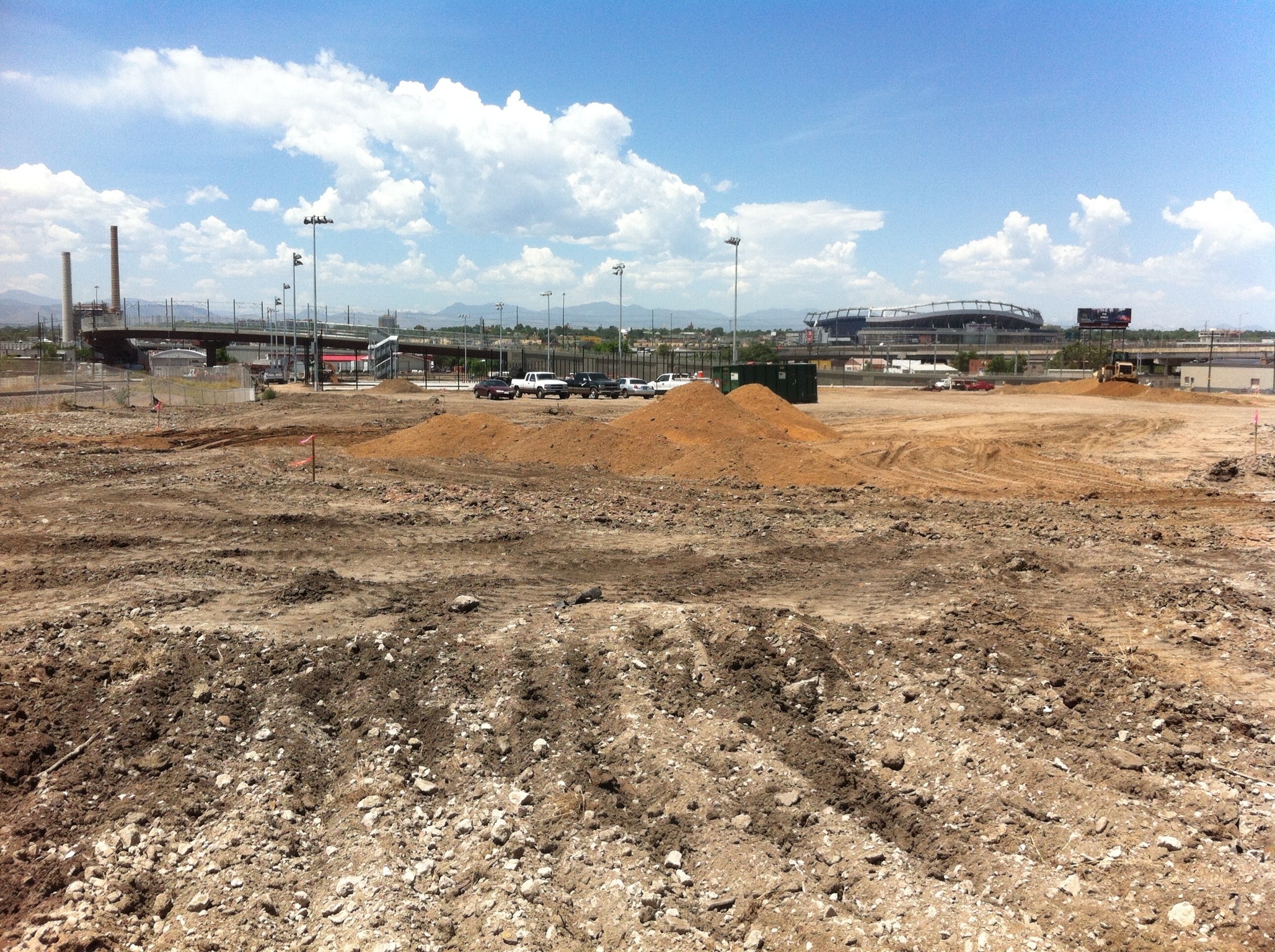
Baker’s Addition 2013. Photo by Dave Stauffer
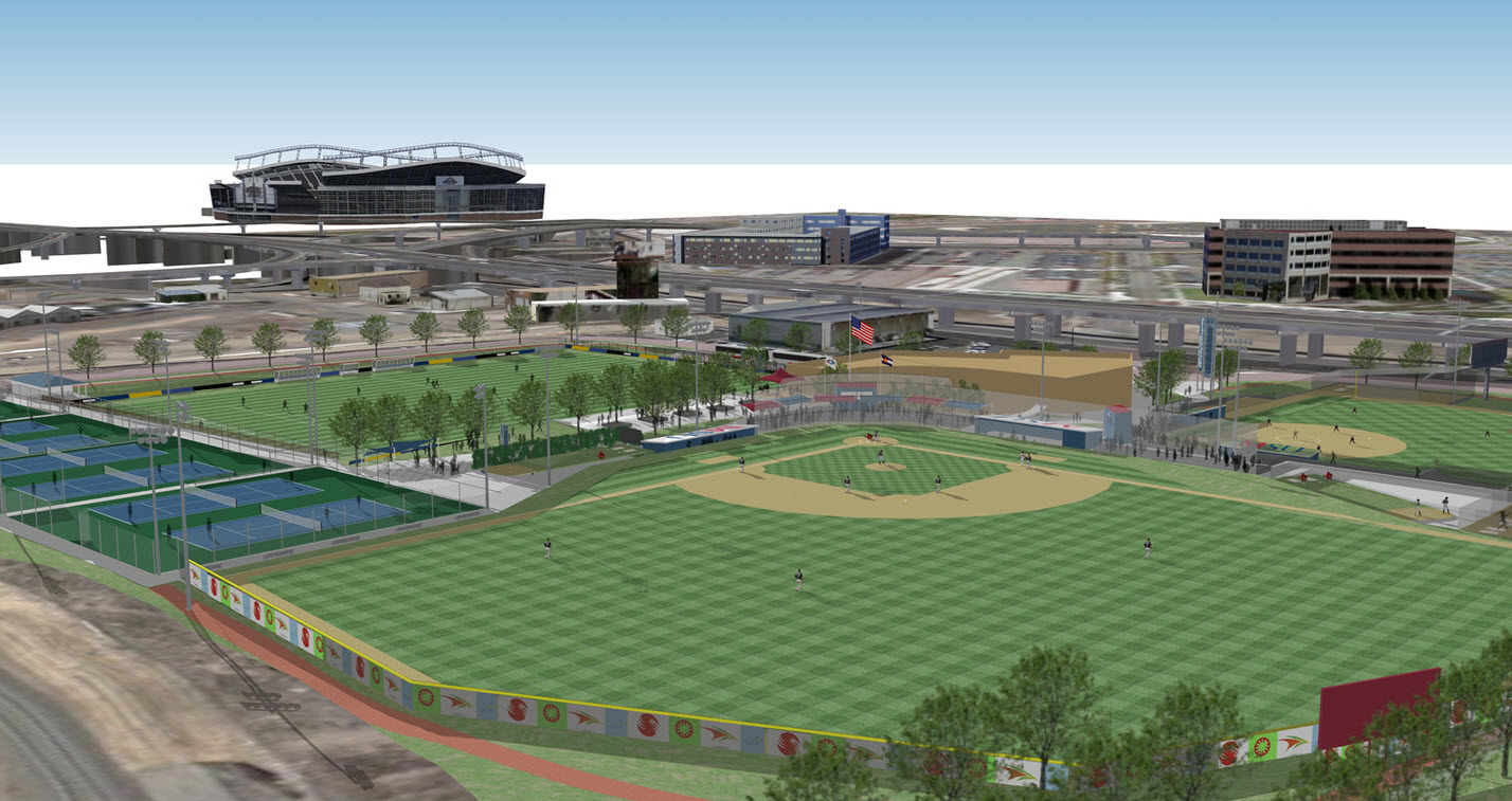
Rendering of MSU Athletic Complex 2014- from gometrostate.com
A New Bird’s View- 1887
This birdie was flying from a new direction. It offers depictions of the Denver CIrcle train in the foreground, and the grand Franklin School on Colfax. The citizens of Clark Street (Inca St) fought the noisy train running down their street for many years until the track was abandoned in 1898. And, West Denver’s first high school stands tall in this landscape, while a long gone church also pops out from today’s 1300 block of Lipan St. behind it.
Birds Eye View of Denver 1887. Courtesy DPL, Western History Collection, C64314.D4 1887>R62

- Franklin School in Denver. Courtesy DPL, Western History Collection, C-67
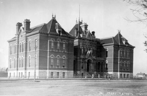

- Franklin School with children in front. Courtesy DPL, Western History Collection WH1990

This surveyor version of the same area from 1887 starts to show which homes were built and establishing “Lincoln Park” as a thriving “West Denver” neighborhood.
Robinson’s Plate 26 1887. Courtesy DPL, Western History Collection C978.81 R562at.1887
A Modernizing Perspective- 1889
The first drawing is like many found, cluttered with other images that conceal the full picture of the Lincoln Park neighborhood.
Perspective map of the city of Denver, Colo. 1889. Wellge, H. (Henry) Courtesy DPL, Western History Collection CG4314.D4 1889.W4
But, the crop from an alternate version does add the best rendering of the looping paths leading to the Hunt home that once covered the land.
Rendering of Hunt’s Homestead Visible. Source: Silver Images of Colorado, Ronzio, Richard A.
Denver, Colo. : Sundance Pub., Ltd., c1986.
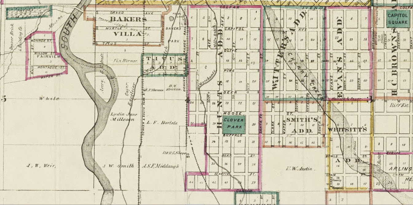
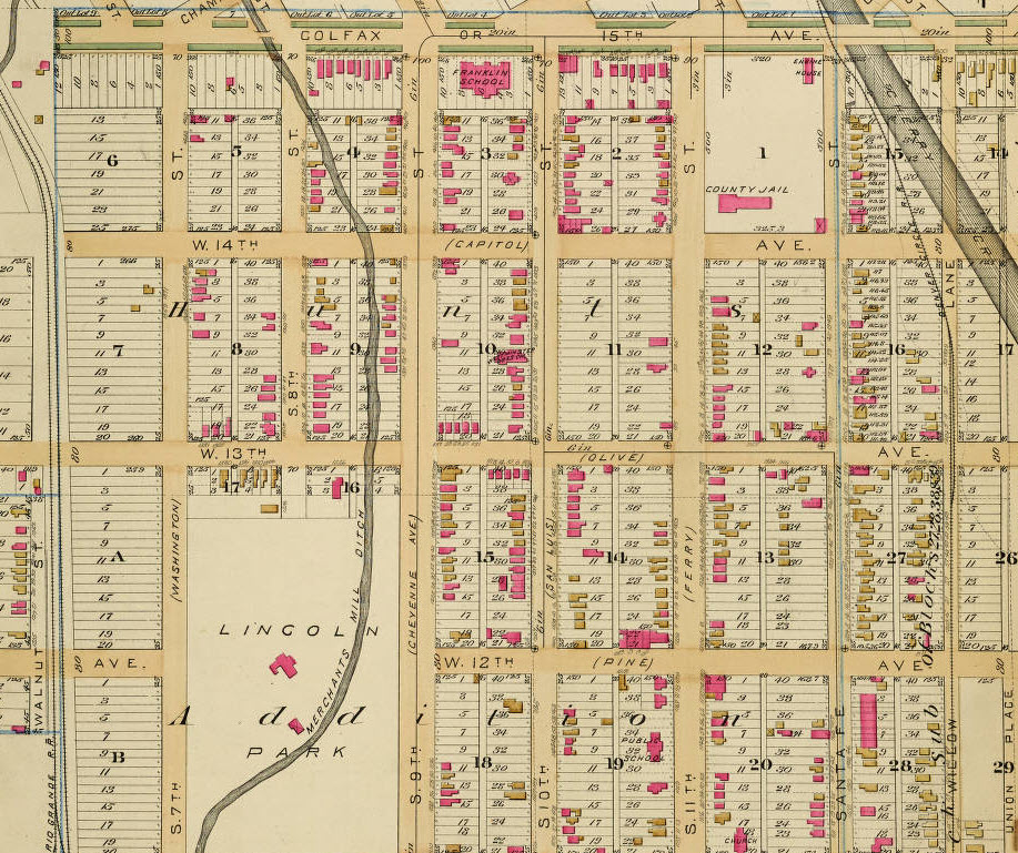
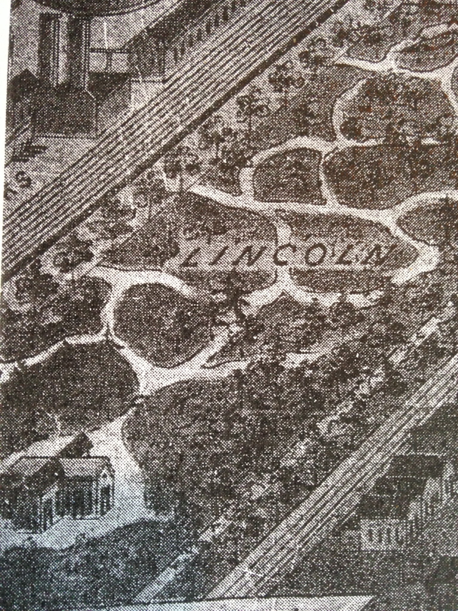
From reading these maps, many of the houses we live in today were already built as the century was coming to a close. Both the1889 drawing and the 1905 map below show significant growth and impressions of a few more lost landmarks. We can see the outline of the the “new” jail, and at least three churches that no longer stand in the neighborhood. Look closer at Lincoln Park and see the outlines of over a dozen houses built along 13th, within the boundaries of today’s park.
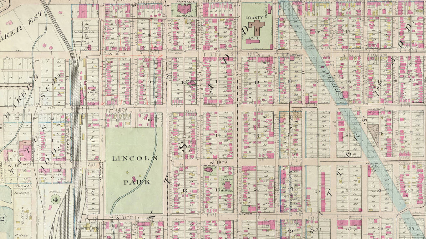
Baist’s real estate atlas of surveys of Denver, Col. (Plate 13) 1905.Courtesy DPL, Western History Collection C912.78883 B165bai 1905
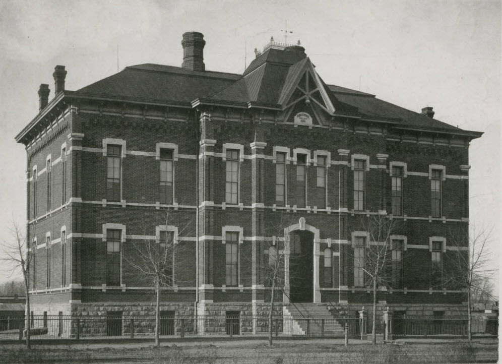
Denver County Jail 1918. Courtesy DPL, Western History Collection X-29712
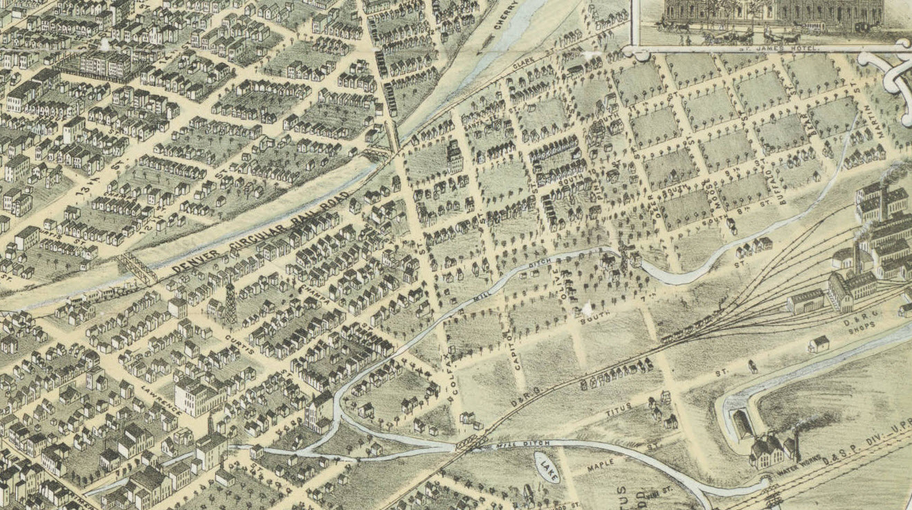
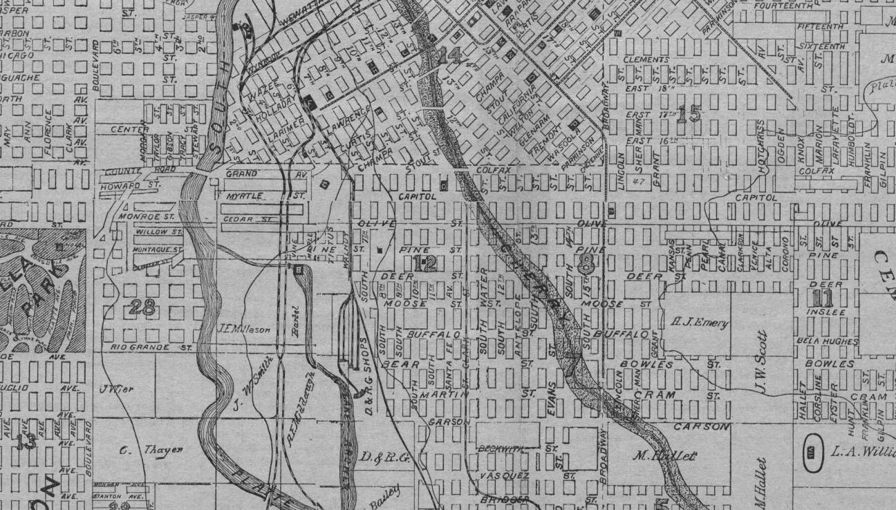
Did you notice the streetcar lines on Mariposa, Kalamath and crossing the Cherry Creek at 11th? You can see the lines more clearly on the Denver City Tramway Map from 1906, as well as the Grand Avenue Powerhouse. In the southwest corner, the hospital and city baseball field are shown. Both Jerome Park (once residential, west of tracks) and Elmwood’s Addition (at southern boundary) are visible below.
(Zoomed) Map of the city of Denver, showing the lines of the Denver City Tramway Co- Beeler, E. M. (Edwin M.) Date taken from text material at top of map which cites franchise results of the city election of May 15, 1906. Courtesy DPL, Western History Collection CG4314.D4 1906.B3
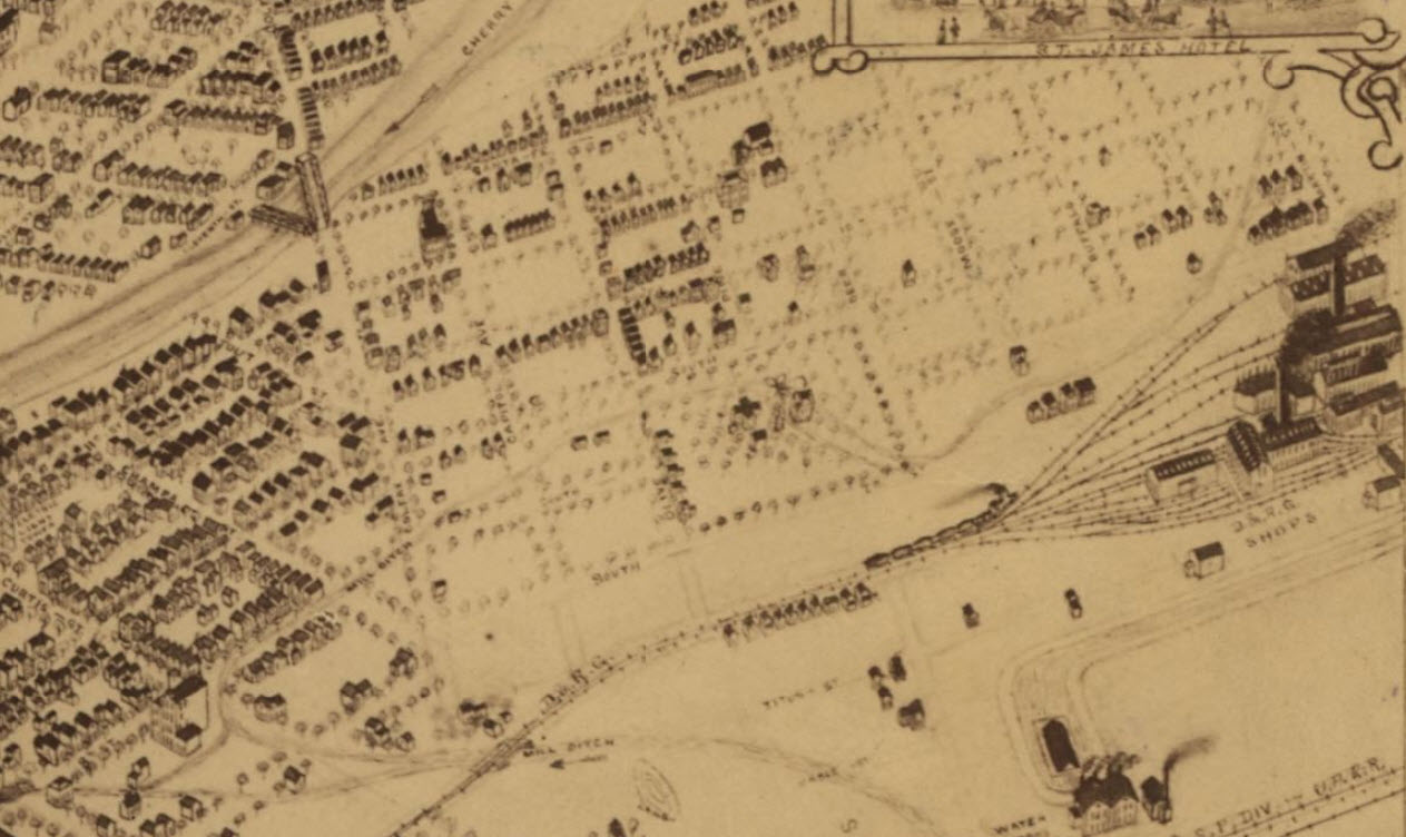
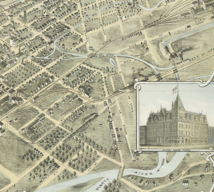
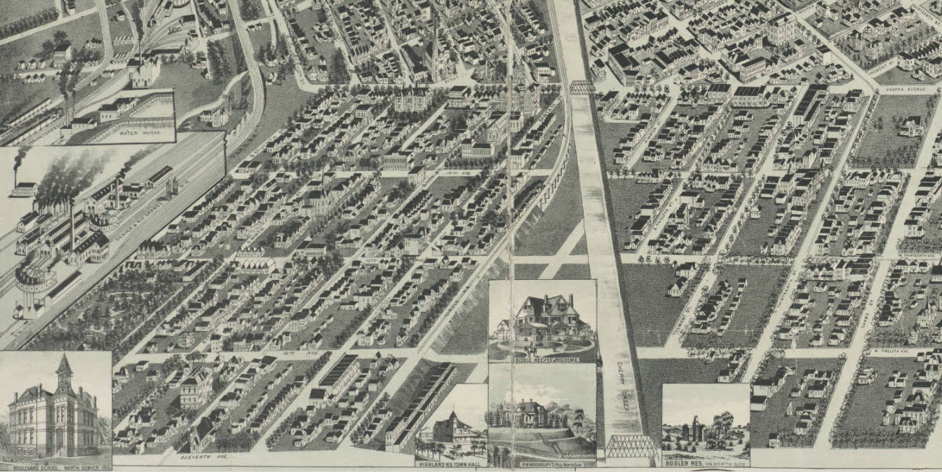
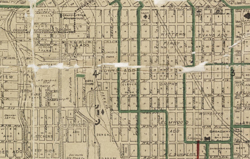
Almost Half a Century Later, Birdseye 1908
These final images offer a lot of clues about the development of the neighborhood, and how much residential architecture has been erased by a hundred years. Fortunately, you can trace many structures still standing today to those represented on the map. They show how Lincoln Park’s waterways and railroads attracted industrial uses and impacted the neighborhood’s evolution. A few visible landmarks: Neef Bros Brewery, the new Jail building next to the Firehouse at Colfax and Santa Fe, Denver Water, County Hospital and a city baseball park.
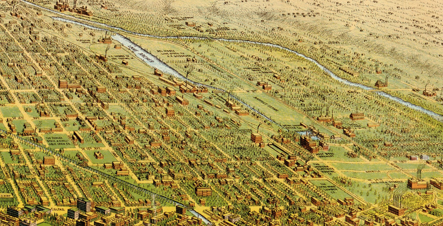
Bird’s eye view of Denver, Colorado, 1908. Birdseye View Publishing Co. Courtesy Library of Congress, Geography and Maps Division G4314.D4A3 1908 .B4
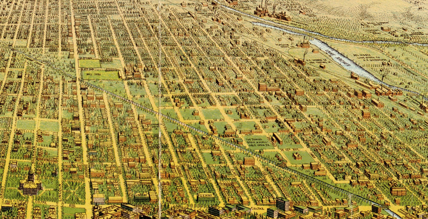
Bird’s eye view of Denver, Colorado, 1908. Birdseye View Publishing Co. Courtesy Library of Congress, Geography and Maps Division G4314.D4A3 s1908 .B4

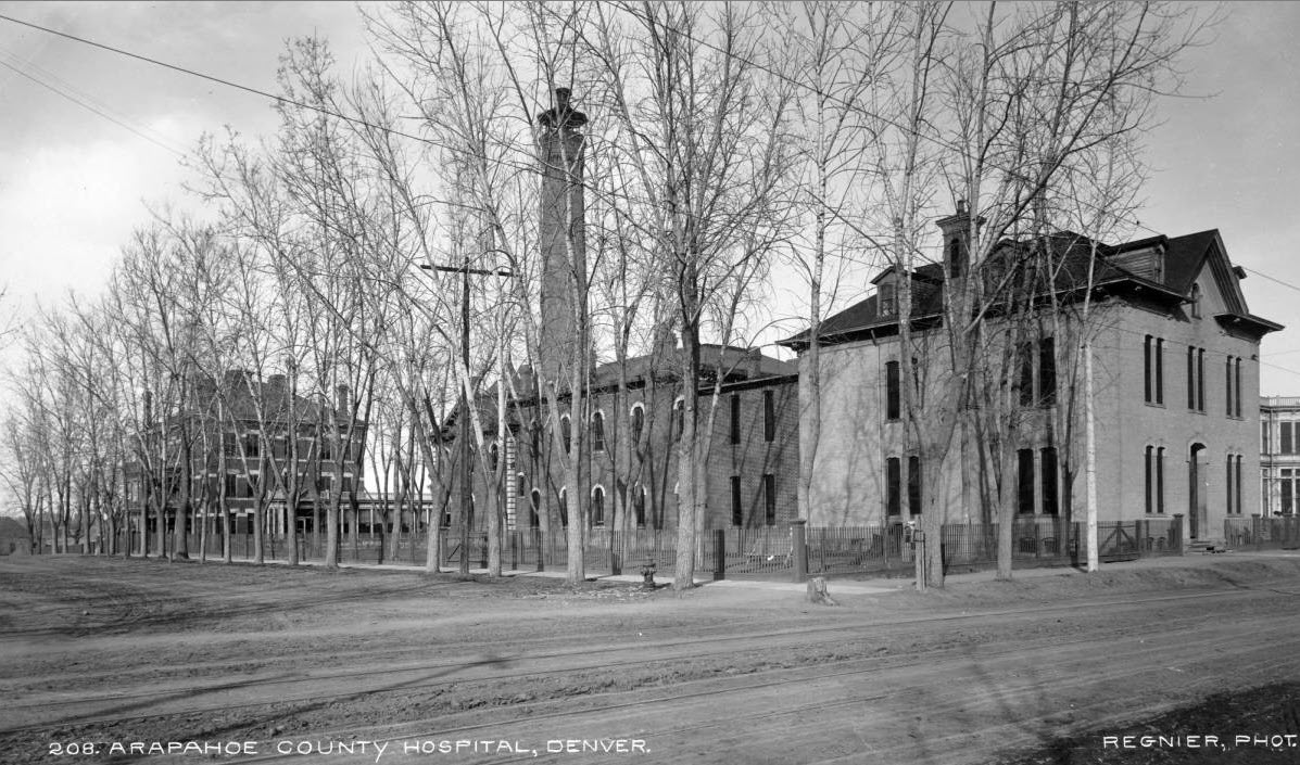
- Arapahoe County Hospital, Denver 1889. Courtesy DPL, Western History Collection X-28724
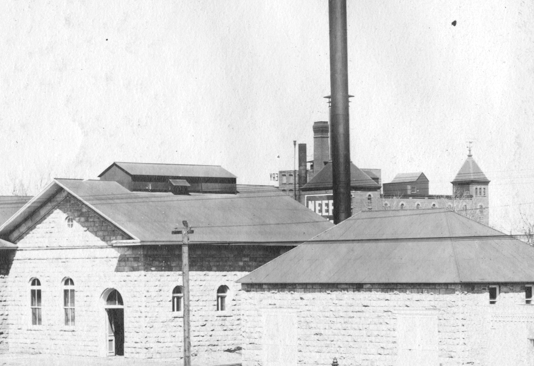
Denver Water’s pipe yard, zoom in on Neef Bros. Brewery, Courtesy of Denver Water Archives.
As a picture is worth a thousand words, I am happy to end with just a few more. I hope loyal readers and neighbors enjoy this timeline and find it a useful source of reference. Let’s continue to explore the land “across the creek,” and the history of Lincoln Park…
I just added a sidebar Gallery on the home page titled “Lost LandmarKs” that should be helpful to reexamine this timeline. Have fun, Lincoln Parqueños.

Pingback: Denver Woolen Mills & J W Smith – Lasting Landmark #2 | Across the Creek