THIS TIMELINE IS STILL A WORK IN PROGRESS
Before Denver
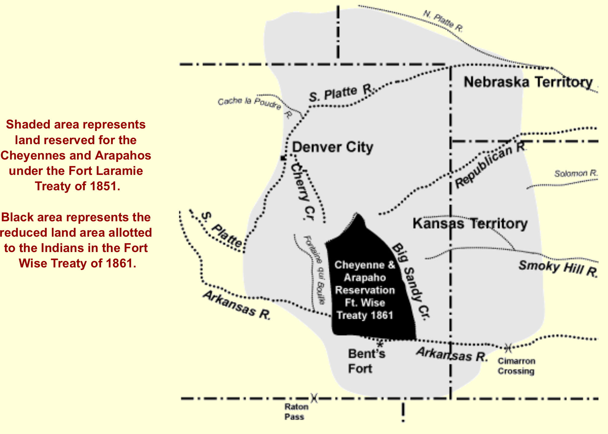
Pre-1858
Many tribes of Native Americans, particularly the Arapaho and Cheyenne, camped freely between the Cherry Creek and S. Platte River. White fur trappers and traders in the region got along with natives peacefully for many years. Explorers, Pike and Long, had surveyed the land acquired from the Louisiana Purchase, and labeled this the “Great American Desert.” They believed it would be an uninhabitable barrier to our “Manifest Destiny” to stretch the US from coast to coast. The Mexican-American War treaty resulted in another large expansion of US territory in 1848, but the area was actually designated as reservation land within the Kansas Territory before reports of gold found here by some boys from Georgia in 1858.
1858-1861 Gold Fever
The Wall Street Panic of 1857 left many Americans in desperate need of new opportunity.While many flocked to Pike’s Peak for quick riches, many of our city’s founding fathers learned from the California Gold Rush of 1849, and understood that real wealth was gained through real estate, and providing utilities and services to the newcomers. Any “improvements” undertaken could help increase the value of the land and bring more “customers.” Panning the creek beds dry of gold quickly, and it turned out that though we had gold in our hills, it was not easy to separate from the rock. Many left Denver worse than when they came.
1862 The Homestead Act
While offering free land to promote settlement was not new, it took awhile for Washington to figure out the rules. The inflammatory politics surrounding the balance of power between slave and free states leading to the Civil War helped shape the destinies of our vast territories.The Homestead Act of 1862 formalized a three-step homestead acquisition process: 1. filing an application, 2. improving the land, and 3. filing for deed of title. Any U.S. citizen or hopeful immigrant who had not borne arms against the U.S. Government (remember the Civil War 1861-1865) could file an application to claim 160 acres of surveyed Government land. For the next 5 years, the homesteader had to live on the land and improve it by building a 12-by-14 dwelling and growing crops. After 5 years, the homesteader could file for his deed by submitting proof of residency and the required improvements to a local land office. This is the basis on which the City began.
Governor A C Hunt
1858-1885
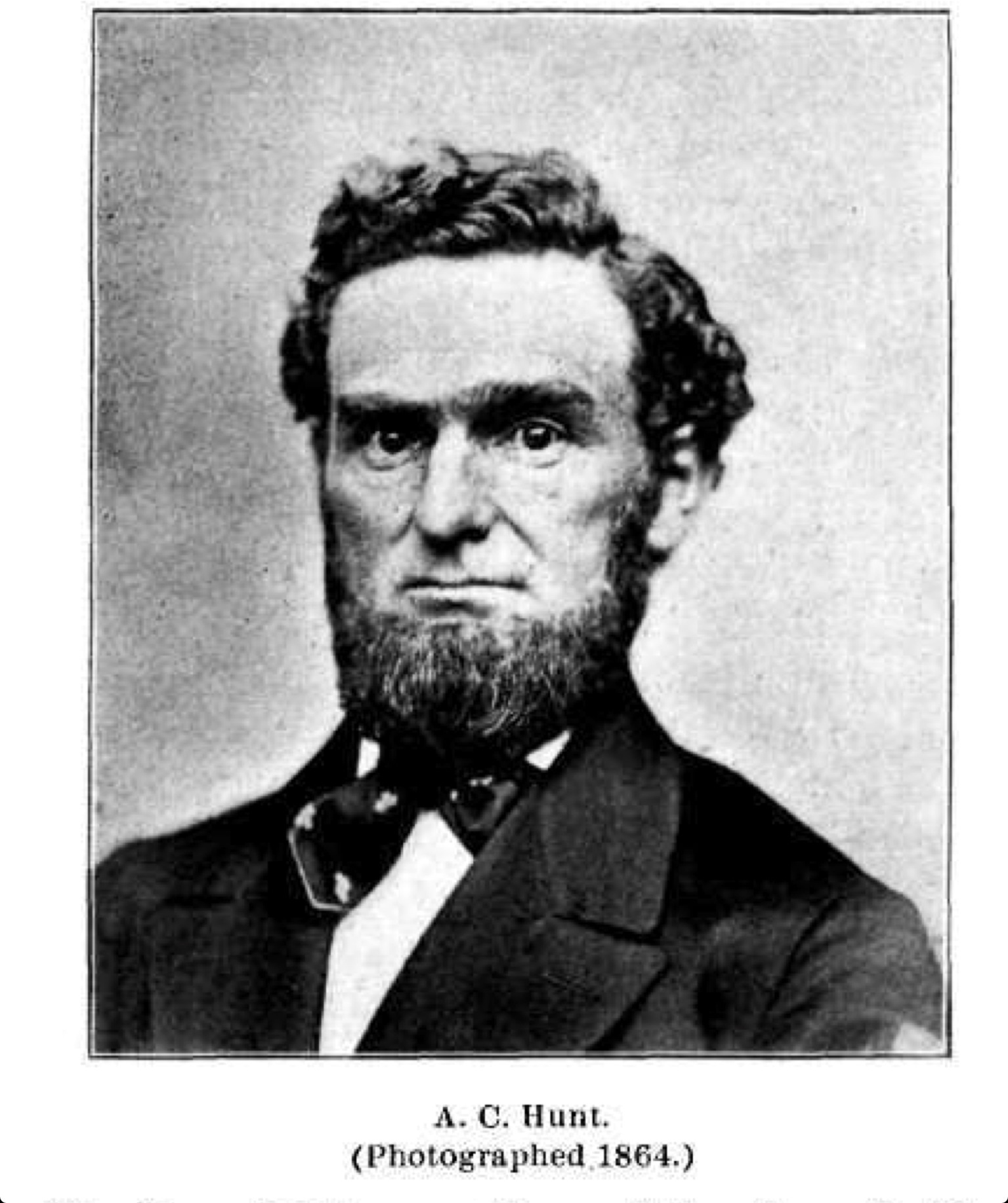
A C Hunt, 4th governor of the Colorado Territory
Alexander Cameron Hunt, the Colorado Territory’s 4th governor, staked his 160 acre claim south of Colfax and west of Santa Fe, covering most of today’s La Alma Lincoln Park neighborhood, and . Hunt’s rambling cottage, located near the center of today’s park, was built in stages, but eventually reached fifteen rooms with a large patio for entertaining.
A C Hunt’s “Cloverside”From Cannon, Helen, First ladies of Colorado–Ellen Kellogg Hunt, Denver (Colo.): State Historical Society of Colorado, 1962. Courtesy History Colorado Call Number: SER Colorado Magazine Vol. 39, no. 2 (pp. 125-132)
Visitors crossing the gate and traversing the winding driveway, would be in Denver’s most lush estate, surrounded by alpine transplants, and Hunt’s agricultural experiments. His most successful crop was alfalfa, which lead to the homestead nickname, “Cloverside.” (Side note: Within Hunt’s Addition is subdivision, Clover Park, between 9th, 10th, Kalamath, and Lipan).
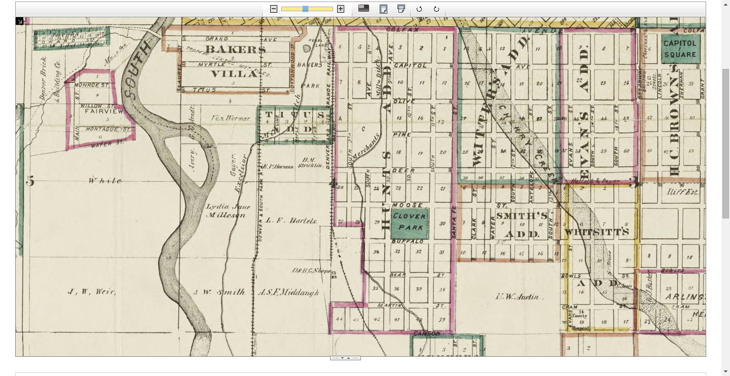
Thayer’s map of Denver, Colorado 1879. Courtesy DPL Western History Collection CG4314.D4 1879.T49
Not only did Hunt serve as Governor from 1867-69, many his of contributions are long forgotten. Hunt:
- served as vice-president of the Auraria Town Company, and presided over the meeting that united the rival settlements of Denver and Auraria
- was “judge” of the Vigilance Committee that helped bring some early rabble-rousers to “justice”
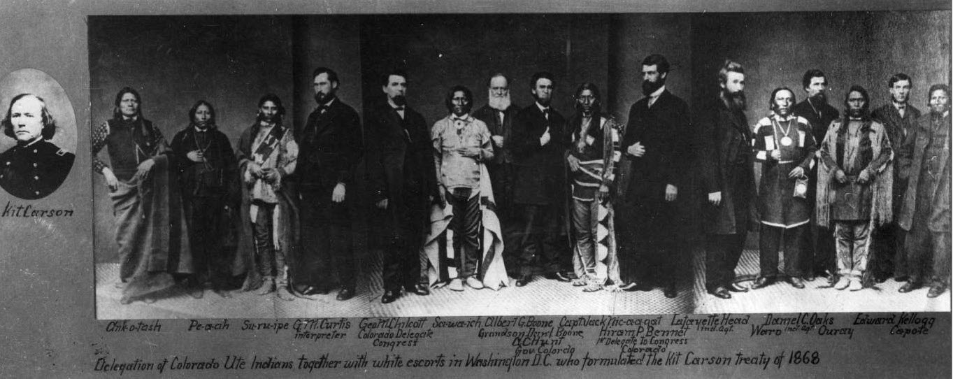
- was appointed US Marshall and Ex-Officio Chief of Indian Affairs by President Lincoln, which utilized his good relationships with many of Denver’s native neighbors to keep the peace

Delegation of Colorado Ute Indians together with white escorts in Washington DC who formulated the Kit Carson Treaty of 1868
- was removed from office by the scandal-ridden Grant administration, though the President later apologized to him for listening to false accusations and offered the gift of a prized stallion
- donated the land at the corner of Colfax and Santa Fe to Denver in hopes of seeing the Capitol building erected there. It became home to the county jail and a firehouse instead

Denver County Jail 1918. Courtesy DPL, Western History Collection X-29712

Old Fire House, Number 2, West Denver Courtesy History Colorado Collection CHS.X4520
- was said to have built the first brick home and introduced the first bee colony to Denver
- was the President of the Capitol Hydraulic Company, the city’s first effort to dig ditches from the Platte to irrigate the new city
- was on the board of the Mining Exposition which helped promote Colorado’s primary industry
- was instrumental in the building of the Denver and Rio Grande RR, surveying every inch of track on horseback himself, negotiating for the land needed, and providing valuable access to the heart of the settlement across his homestead

After his wife, Ellen, passed and his son was slain by a bank robber in Durango, A C Hunt focused his energies on completing his vision of a railroad stretching to Mexico City. He left Denver behind by 1885 when Lincoln Park was officially named.
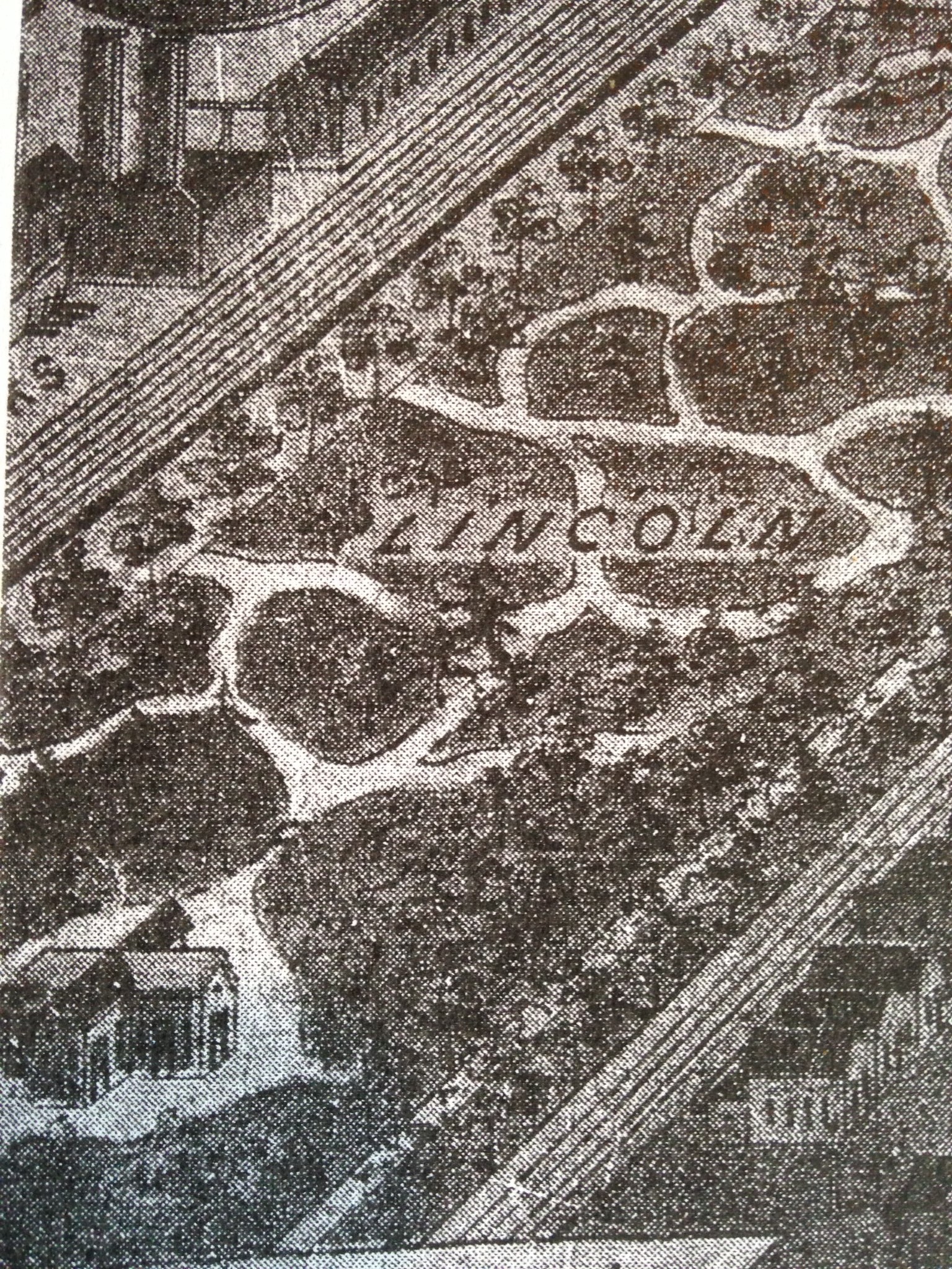
Lincoln Park, Source: Silver Images of Colorado, Ronzio, Richard A.Denver, Colo. : Sundance Pub., Ltd., c1986.
Camp Weld
1861-1865
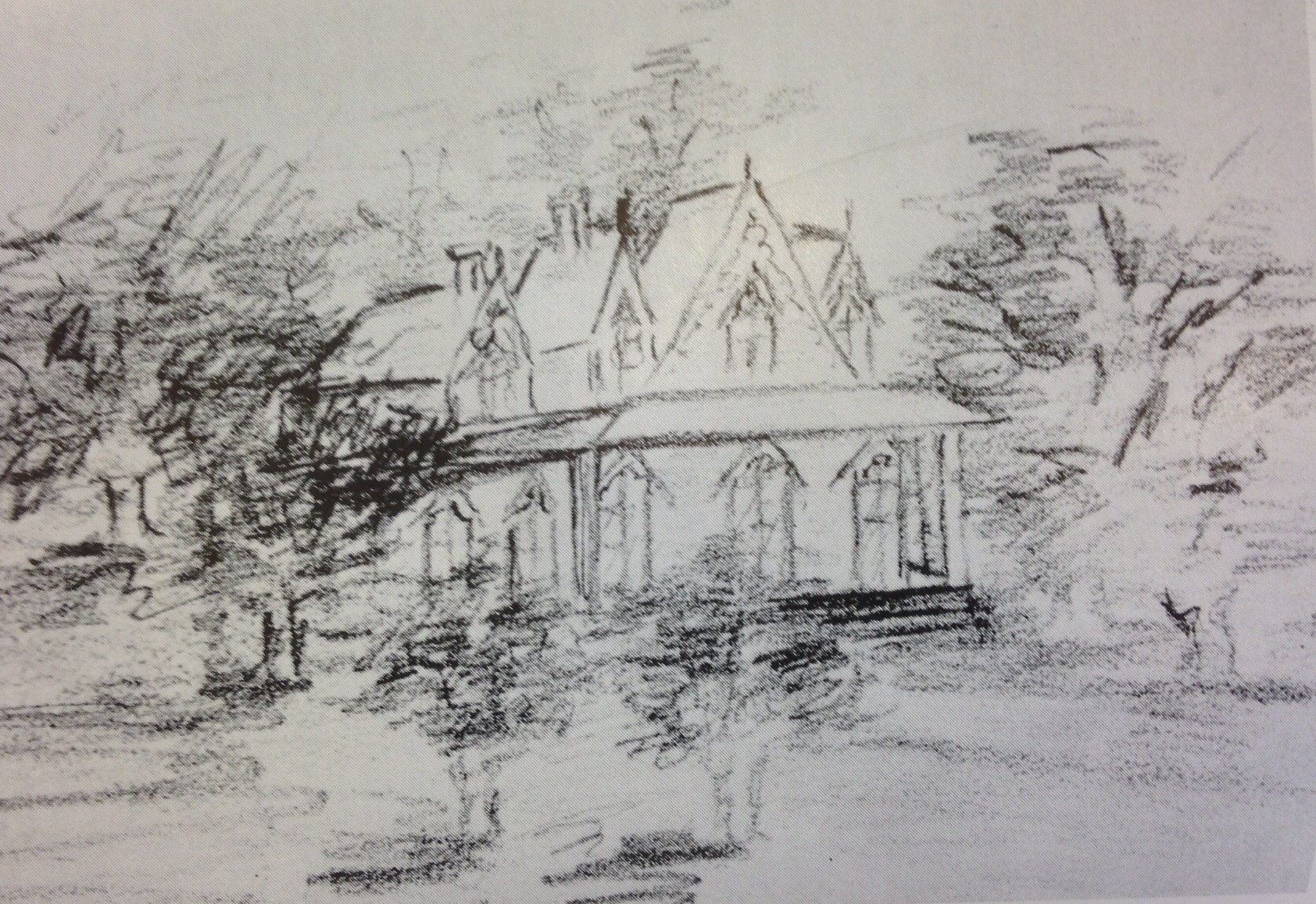
Not only did the Civil War disrupt the progress of Denver’s initial boom. the conflict between the North and South heightened feelings of isolation, while drawing us into the fight. First, Colorado was made an official territory in 1861, an usual step for so little a population.Though Southern sympathies existed, the extent of of support was unclear at the time. Governor Gilpin was appointed to the first governorship and quickly took to the task of preparing against the threat of a Confederate invasion from Texas. Camp Weld was constructed on thirty acres, east of the Platte and north of today’s 8th Avenue bridge.
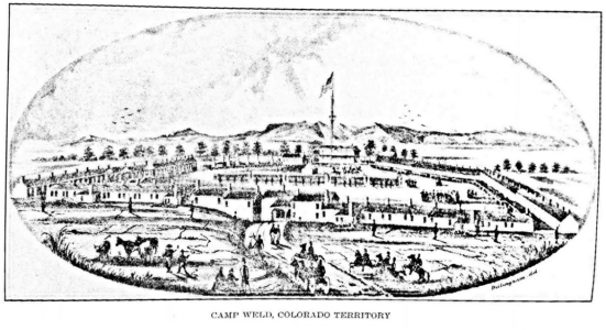
The best image remaining of the camp is this sketch by J.E. Dillingham
The camp was used to organize and train troops for the defense of the Union. Colorado’s First Volunteer regiment is credited with beating back the Texan advance, and ending the Confederate ambition of acquiring the mountains of wealth in the West. However, the glory earned at Glorieta Pass in New Mexico would be forever obscured by the Third Cavalry’s shameful legacy, the hundreds of Cheyenne and Arapaho women and children slain in the Sand Creek Massacre. After two damaging fires, the remaining timber from the camp would find better use elsewhere in town, and the defenders were dispersed to more imminent threats throughout the territory. Then, one thoughtful soldier staked a homestead claim on the land and raised his family in the last standing section of “Officer’s Row.” He planted orchards and built fish ponds on the acreage, operating a market and picnic ground for many years afterward.
A monument still stands today to mark the spot.
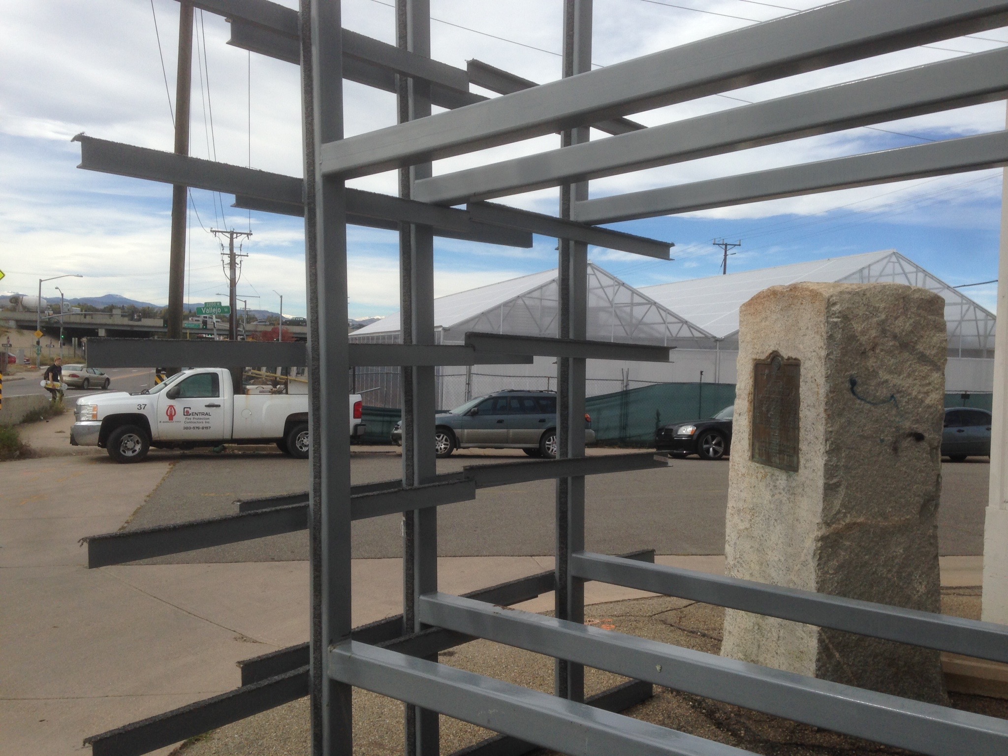
Camp Weld Marker 2014
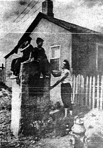
Camp Weld in 1930’s
The First Great Flood
May 19th, 1864
There likely is no single event that impacted West Denver than the flood of 1964. The summer the first settlers arrived, the Cherry Creek was no bigger than a stream surrounded by a wide and dry bed. After the natives saw the newcomers’ buildings rise close to the water, they warned that the creek would one spring day furiously overflow, when rain combined with the melting snow.
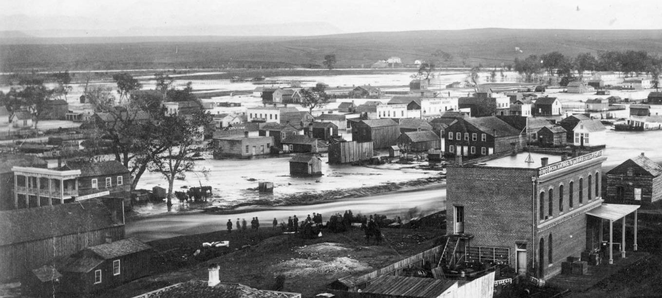
Great flood in Denver May 19 1864- View West of Cherry Creek
Once the Civil War was over, and Denver began to grow again, West Denver was left to industry and working classes, while the rich moved to higher ground around today’s Capitol Hill.
J W Smith
1860-1867
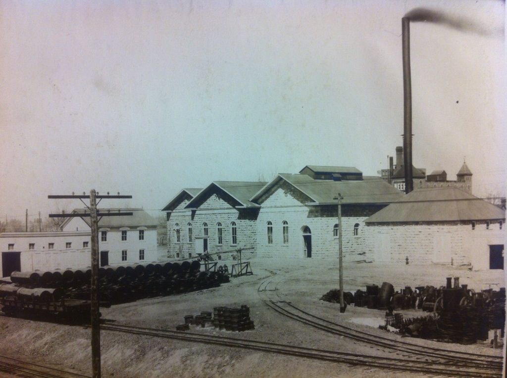
Smith arrived in 1860 with a wagon train of merchandise for a general store, and machinery to equip three mills. Importantly for Denver, he also delivered a steam-powered machine that could was reported in William Byer’s Rocky Mountain News to be capable of “digging better than a thousand men.” The “City Ditch” or “Smith’s Ditch” was completed in 1867 and ushered in a new era of civilized living to the city. More significant to La Alma Lincoln Park, Smith owned two separate plots of land here and each retains a lasting landmark of Smith’s legacy. The first is Smith’s Chapel, now known as La Academia campus of the Denver Inner City Parish. The other was Denver’s first wool mill, located in the neighborhood’s most southwestern corner, and is home today to City Bark.

Denver’s 1st Woolen Mill is now City Bark. Image shot from Denver Water.
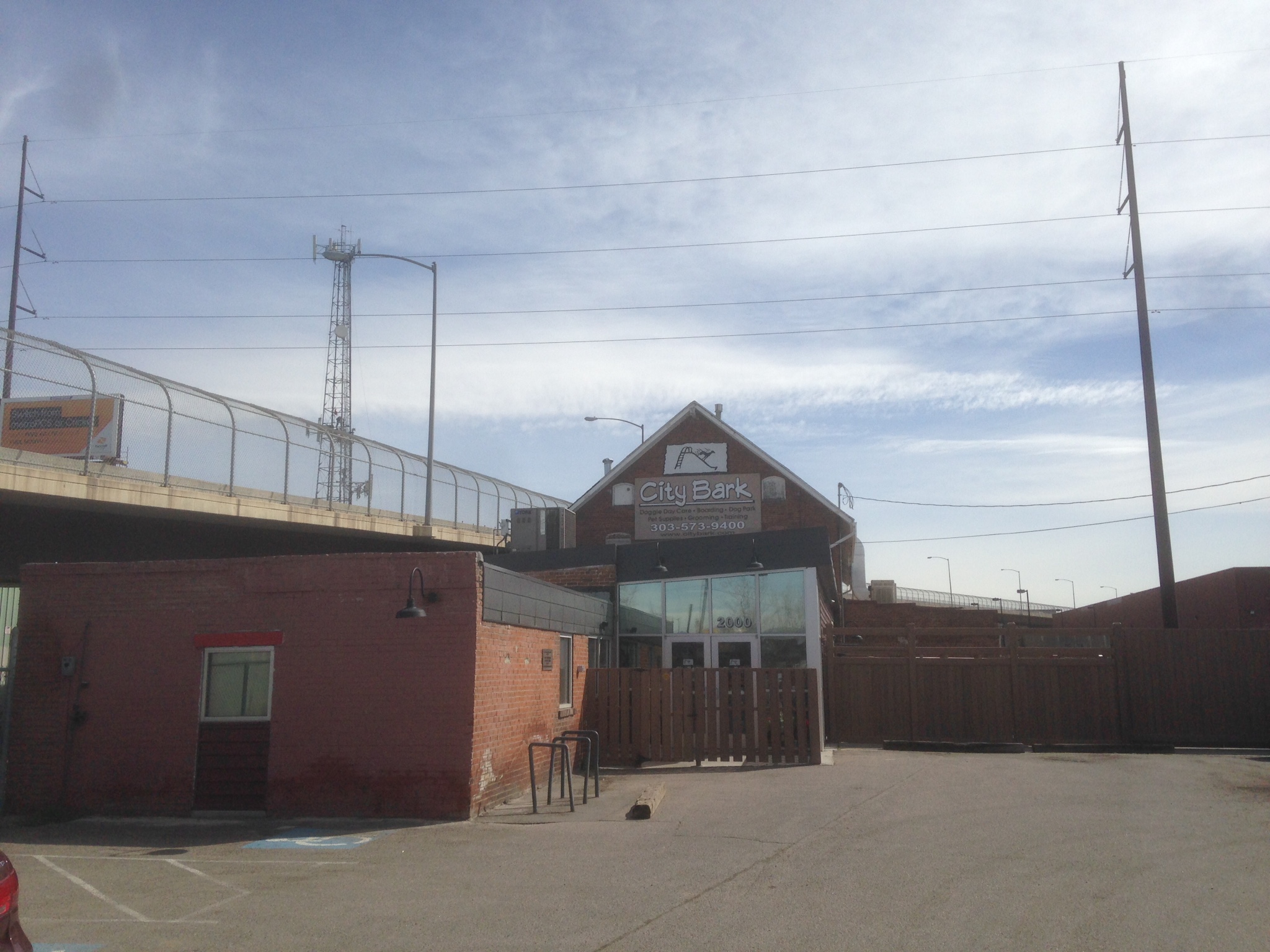
Front View of City Bark
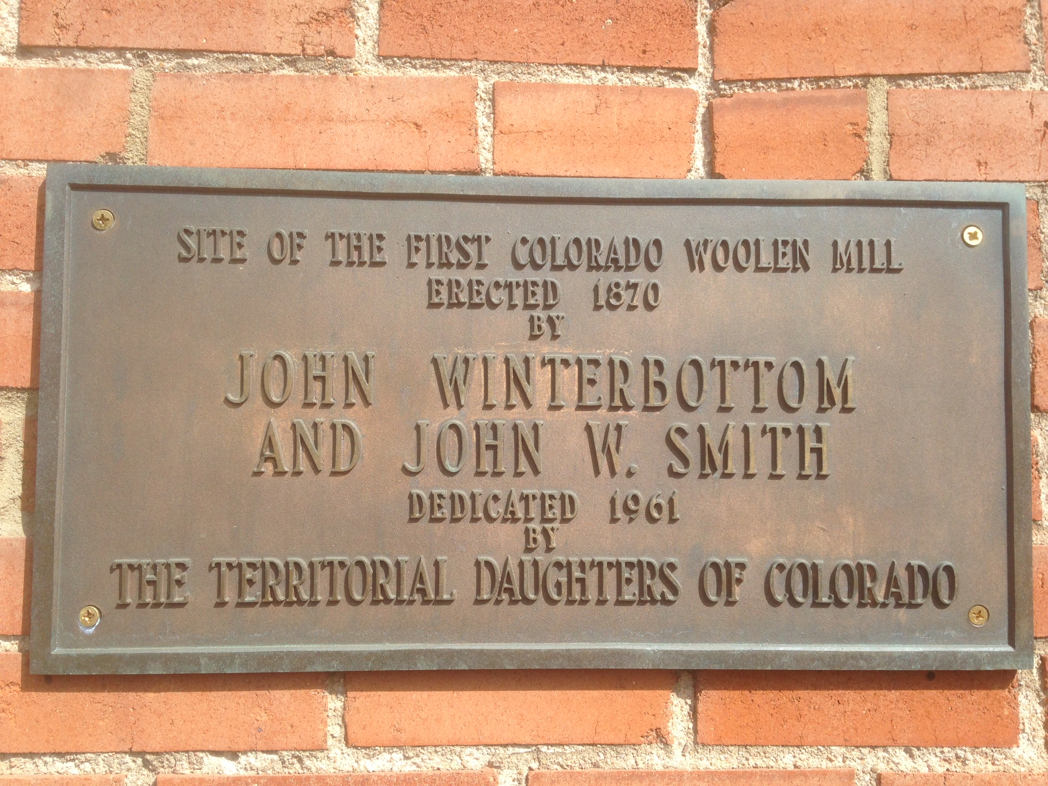
Bronze Plaque is visible from the front of City Bark
The Denver and Rio Grande Railroad
1870- Now Union Pacific RR
Soon after Denver residents successfully built their own extension to the Kansas Pacific inter-continental RR in Cheyenne in 1869, General William Jackson Palmer and A C Hunt began to construct a narrow gauge railroad that would both provide access to Colorado’s mining and agricultural assets, and finally provide the stimulus to development that Hunt had long hoped for with his homestead.The buildings still standing from before 1900 were the homes and businesses of working class citizens, close to the jobs provided by the D and RG Shops, and many new factories and businesses that followed.
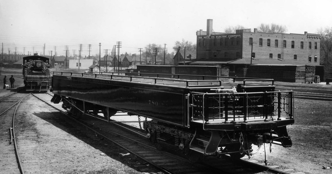
Denver and Rio Grande Excursion Car, Burnham Yard 1905. Courtesy DPL Western History Collection GB-8459
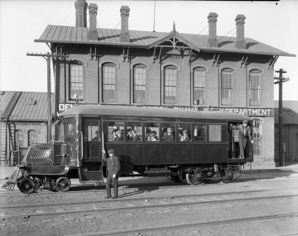
Mack RailBus on trial at D and RGW Burnham Shops. Courtesy DPL Western History Collection GB-8100
Lake Archer to Denver Water
1880- today
The project involved a 2.44 mile canal from the Platte, which widened to provide a reservoir attached to the pumping station and the network of underground pipes throughout the city. Not a trace remains of the large holding pond that stretched from near Alameda Avenue to Seventh Avenue. It was called “Lake Archer,” named after the unexpected death of the company’s founder in 1882.
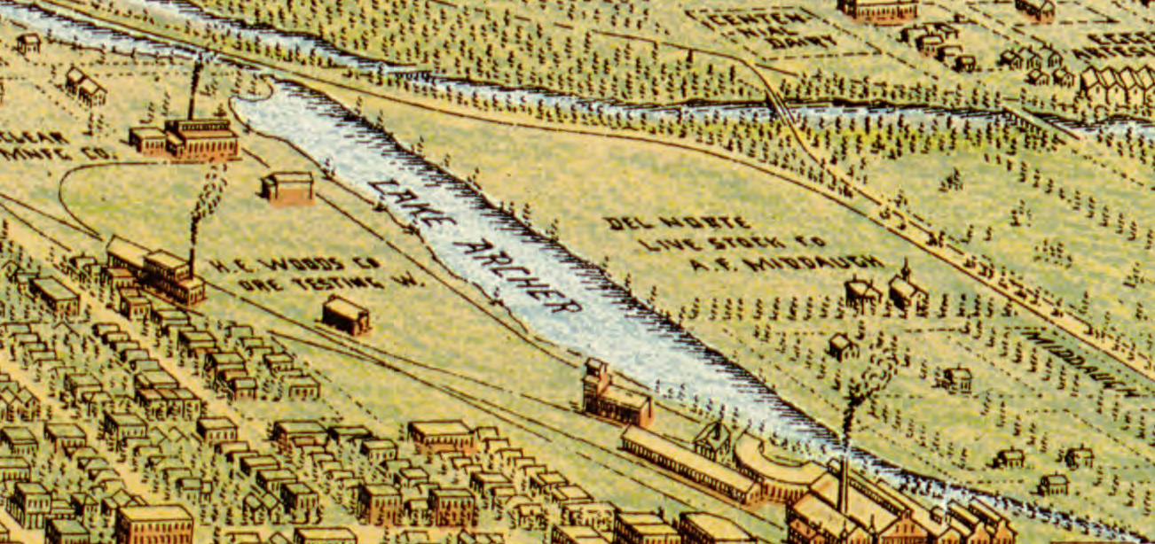
From Perspective Map of the City of Denver, Colorado ,1889 by Wellge, H. (Henry), American Pub. Co., 1889. Courtesy The Denver Public Library, Western History Collection, CG4314.D4 1889.W4
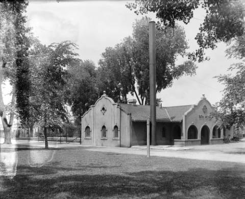
Still fearful of the quality and subject to shortages, citizens soon realized they would have to take it from the mountain. A landmark of the original water works facility is still standing today on Denver Water’s 12th Ave campus. The “Three Stone” buildings that housed the pumping apparatus has been converted to a company and community meeting space that doubles as a museum of Denver Water history.
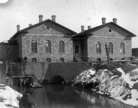
Courtesy DPL, Western History Collection, X-18935
Streetcars
1871-1950

Champa Street horsecar DPL X 27856
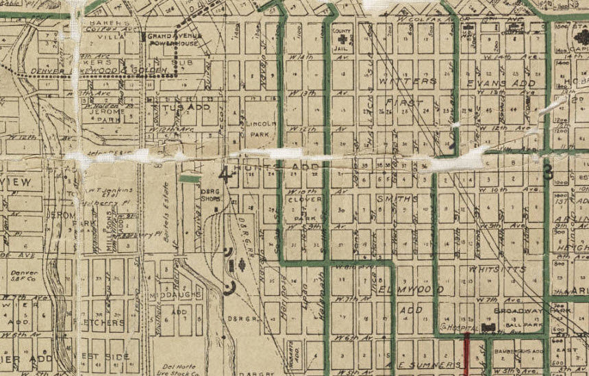
Map of the city of Denver, showing the lines of the Denver City Tramway Co–also the terminal properties of the Northwestern Terminal Railway Co. known as the Moffat Road Terminals (Zoomed) . Courtesy DPL, Western History Collection CG4314.D4 1906.B3
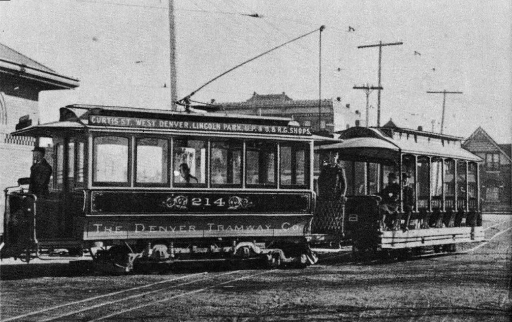
The Denver Tramway Co Car used in Lincoln Park, DPL Western History Collection C388.460978 D437as
Silver Panic of 1893
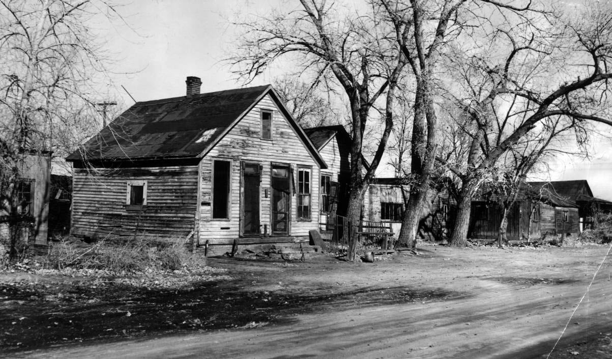
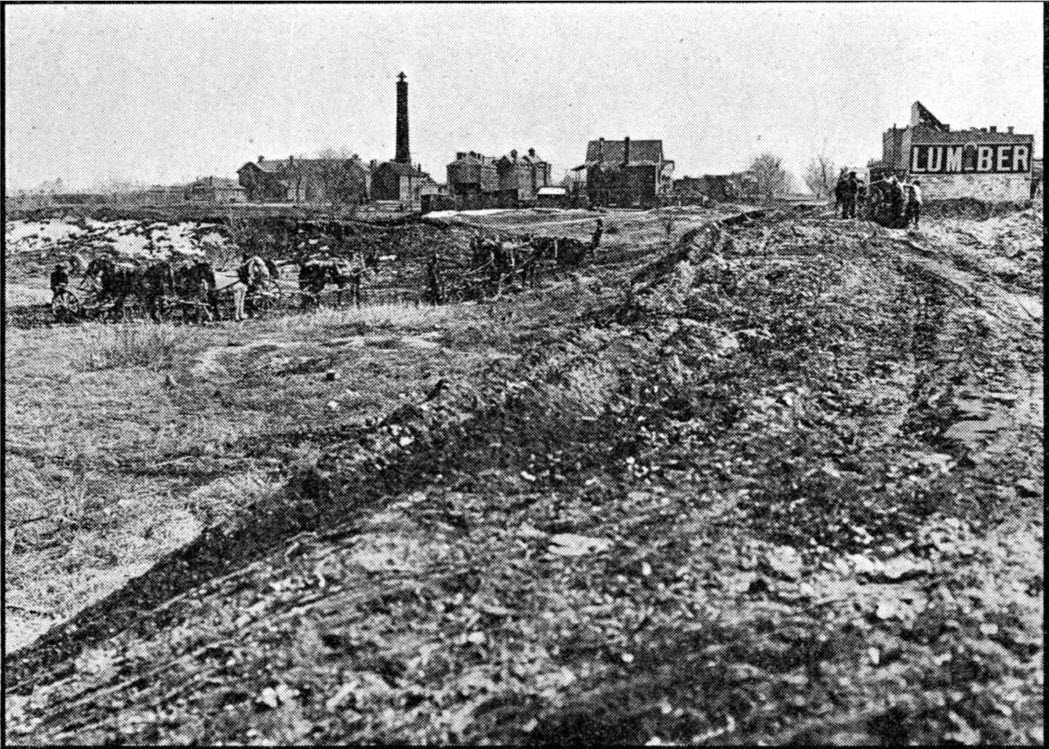
Ugliness soon will vanish- 9th Street Lincoln Park, DPL Western History Collection X-22407
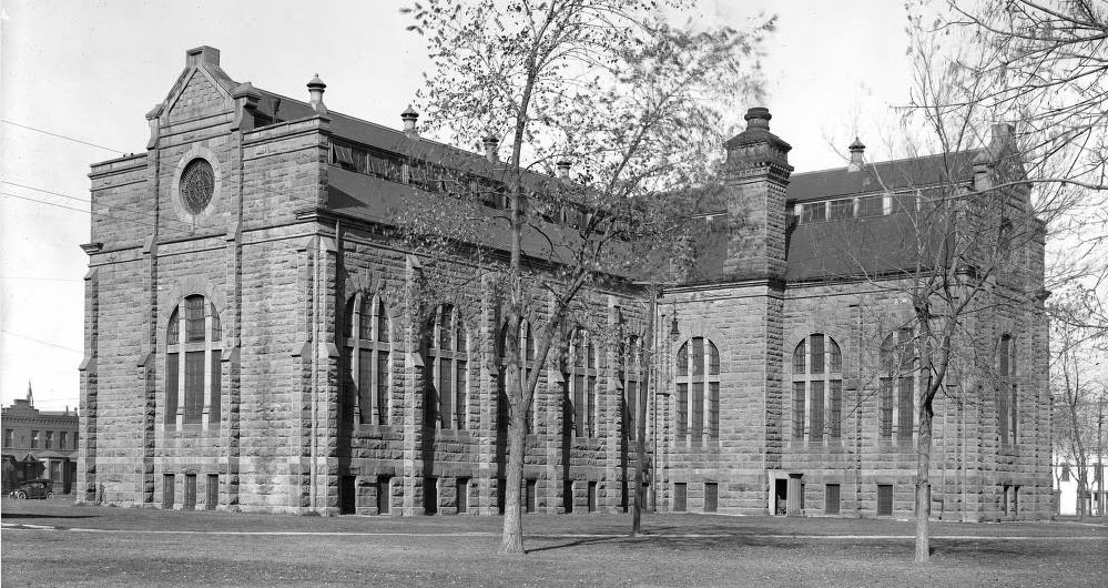
City Hospital to Denver Health
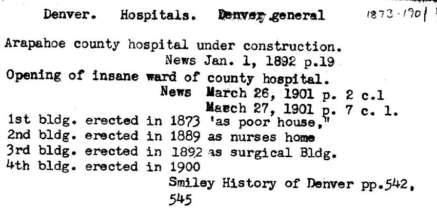
Denver General Hospital Card Catalog Entry
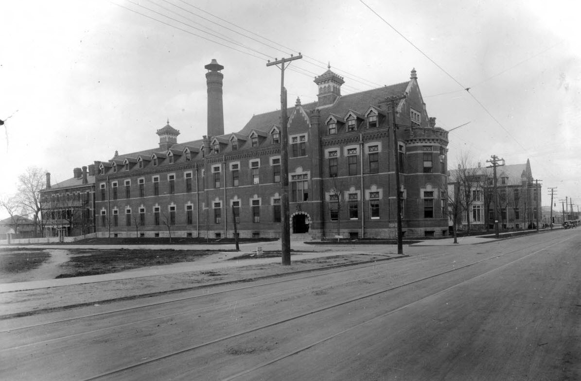
Denver General Hospital Approx 1910, DPL Western History Collection, X-28546
Central School
1880-1952
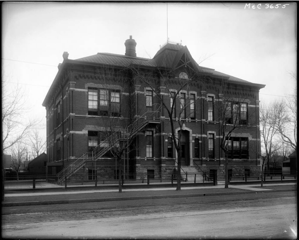
Central School at Kalamath Street and West 12th Avenue, DPL Western History Collection MCC-3655
Franklin School
1883-1952
Franklin School located on West Colfax and Stout Street (between Lipan and Mariposa) in Denver, Colorado. Franklin school was a secondary school from until 1893, then an elementary school until razed in 1952

Franklin School with children in front. Courtesy DPL Western History Collection WH1990
The Great Depression began soon after the stock market crash of October 1929
First Public Housing Built
1940
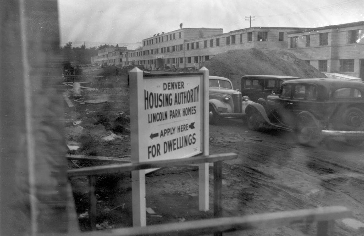
Denver Planning, Urban Renewal, Lincoln Park project 1940, DPL Western History Collection X-29034

Denver urban renewal, Lincoln Park project, 1940. DPL Western History Collection X-29032
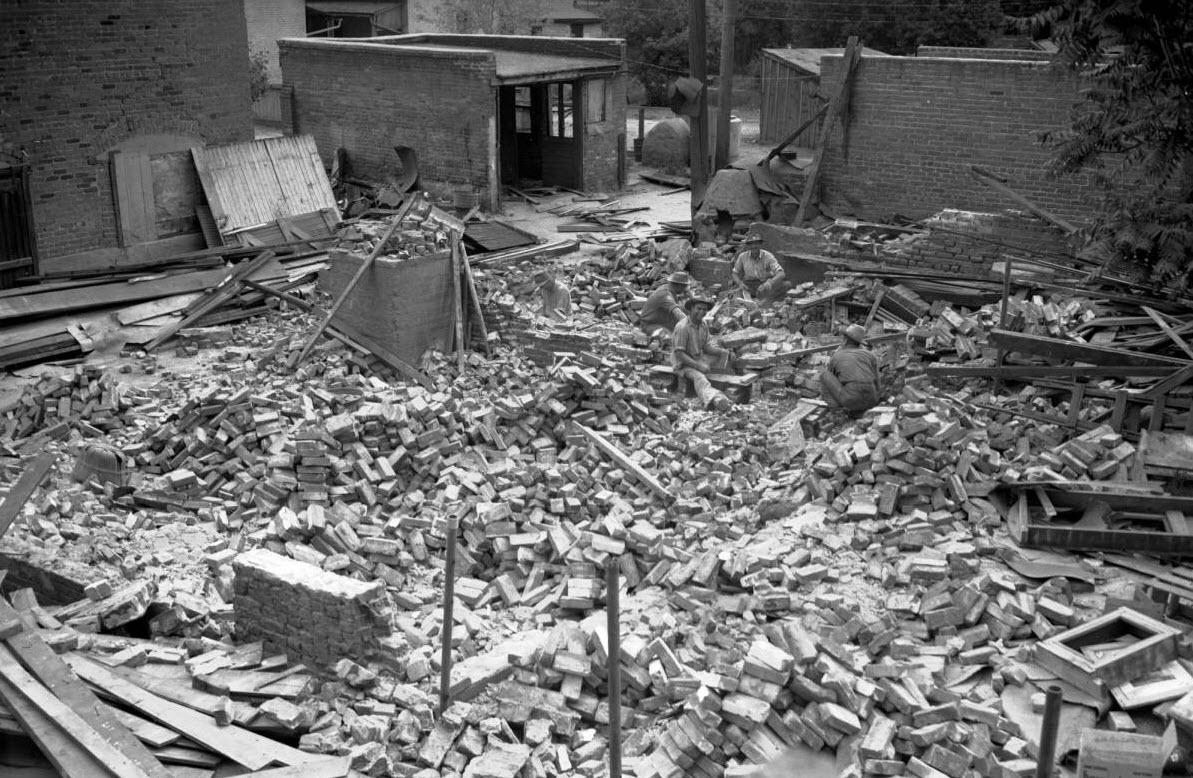
Lincoln Park project, clearing 1940, Courtesy DPL Western History Collection X-29031
West High
1925-
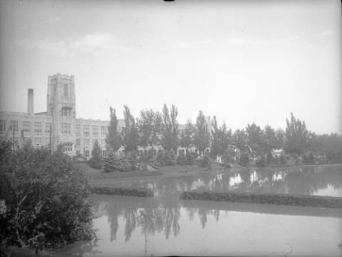
Courtesy Denver Public Library, Western History Collection, X-29321
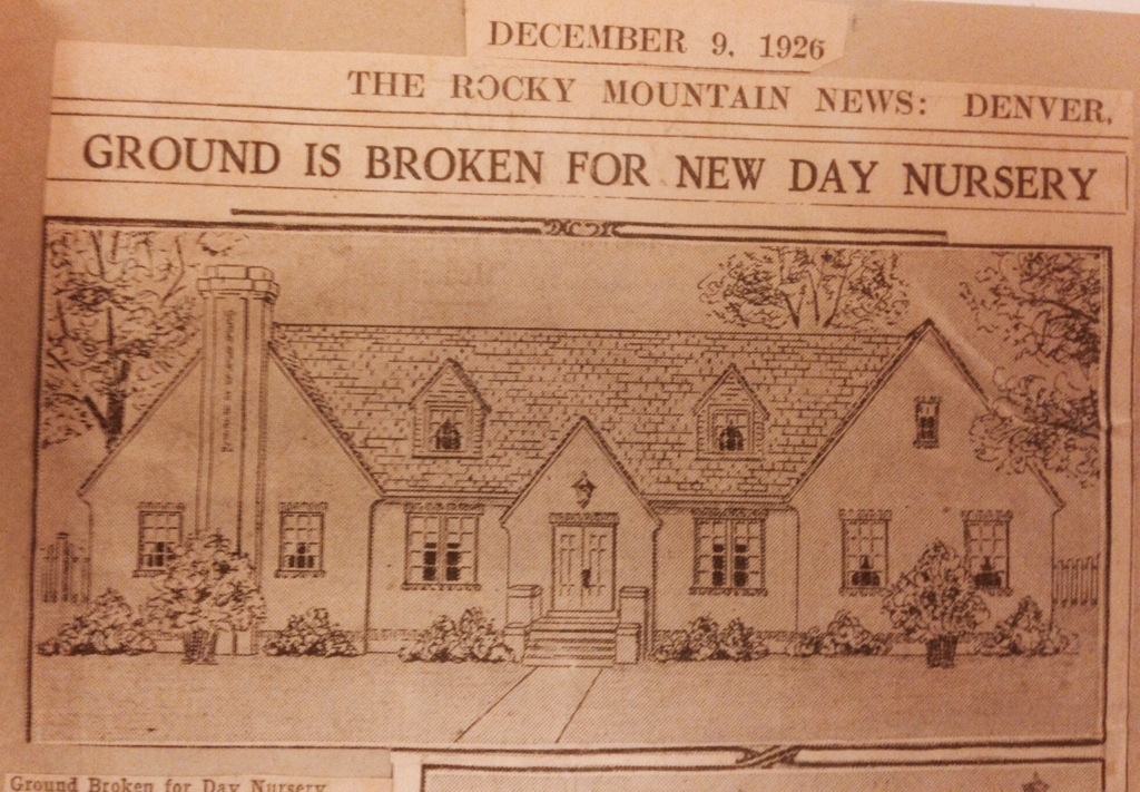
Neighborhood House
1902-1927-

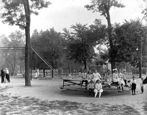
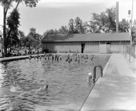
Speer’s City Beautiful
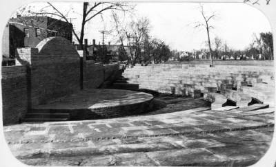
1904-1918
Before Sunken Gardens Construction 1908. From Denver Municipal Facts 1912 May 18. Courtesy DPL Western History Collection C352.078883 D4373mu

Sunken Garden, Speer Blvd., Denver, DPL Western History Collection MCC-1939
Courtesy the Denver Public Library, Western History Collection, X-20310
Courtesy the Denver Public Library, Western History Collection, X-27750
Courtesy the Denver Public Library, Western History Collection, X-27633
Courtesy the Denver Public Library, Western History Collection, X-27634
