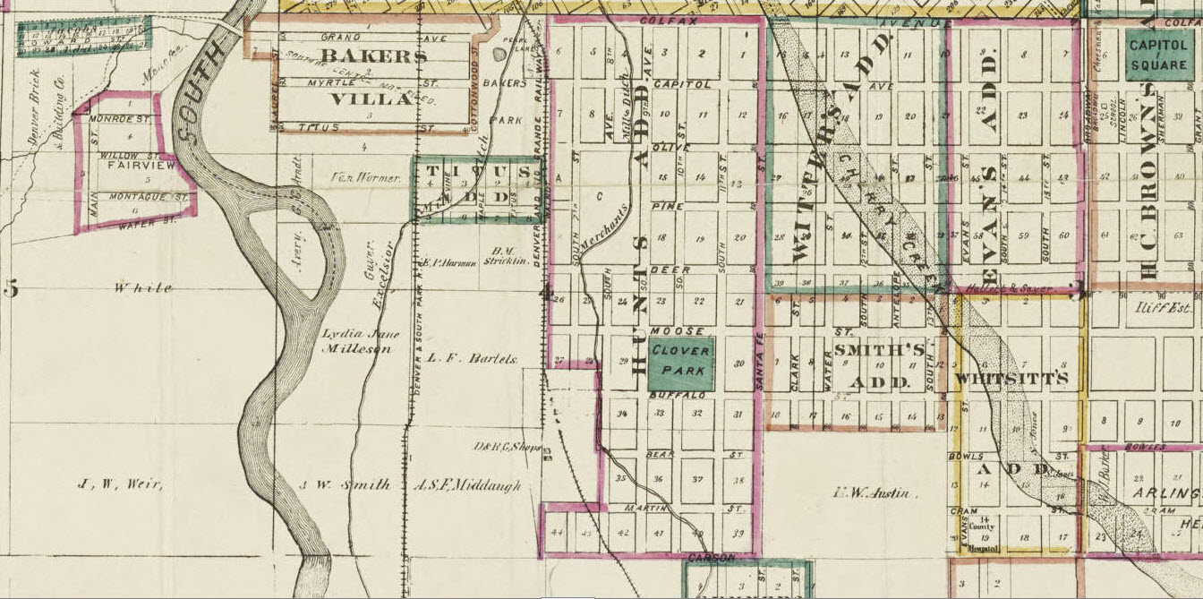
Thayer, H. L., 1879 Shows congressional grant, additions, Highland area, land ownership, bodies of water, and cemeteries.; Also shows routes of Colorado Central Rail Road, Denver and Rio Grande Railway, Denver & South Park R.R., Denver Pacific R.R., and Kansas Pacific R.R. through Denver.; “John J. Riethmann” in lower right corner.; “Entered according to Act of Congress in the year 1878 by H.L. Thayer in the Office of the Librarian of Congress at Washington” at bottom left.; “… Real estate mining and loan agent” beneath H.L. Thayer.; Text includes a general directory with addresses for government offices, hospitals, railroad depots, banks, Western Union telegraph, newspapers, academies and schools, churches, hotels, and places of amusement. Also includes distances from major cities to Denver.; Includes illustrations: four vignettes of the high school on Arapahoe St., Charpiot’s Hotel, and two views of 16th Street in 1859 and 1877.; Some areas have what appear to be hand-drawn, colored outlines with no key, and some parks are filled in with green ink. DPL Western History Collection CG4314.D4 1879.T49
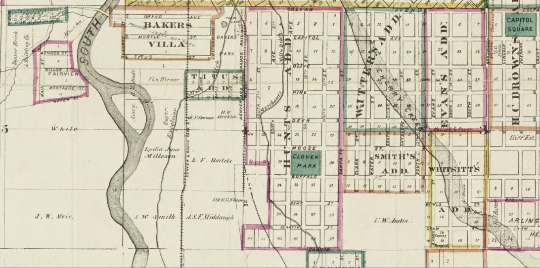
Thayer’s map of Denver, Colorado : Located in Tp. No’s 3 & 4 South Range No. 68 West Arapahoe County. Courtesy DPL Western History Collection CG4314.D4 1879.T49
